Category Archives: Walks

The Story of a Square 9: Soho Square

Soho Square was built in the 1680s by Richard Frith who had obtained a license indirectly from the landowner, the Earl of St Albans. The area had been farmland that had become a popular location for hunting and the most likely origin of the area’s name is that ‘So-Ho!’ was a hunting cry. By the 1670s building in the area was gaining momentum and it was popular with significant courtiers and aristocrats.

The Square had forty one houses by 1691 of which the most significant was Monmouth House on the south side, London home of Charles II’s illegitimate son the Duke of Monmouth. The print of c. 1700 below looks south across the Square towards Monmouth House with its forecourt behind railings. Monmouth was executed after his failed rebellion against his uncle, King James II, in 1685. The house was eventually demolished in 1783. In John Evelyn’s Diary he records spending the winter of 1690 ‘at Soho, in the great Square.’

The Square was also known as King Square after Charles II. In 1720 John Strype wrote that the Square ‘hath very good Buildings on all Sides, especially the East and South, which are well inhabited by Nobility and Gentry.’ He described the garden in the centre as ‘a very large and open place, enclosed with a high Pallisado Pale, the Square within neatly kept, with Walks and Grass-plots, and in the midst is the Effigy of King Charles the Second, neatly cut in Stone to the Life, standing on a pedestal.’ It stood in a basin of water with figures representing the rivers Thames, Trent, Humber and Severn. The sculptor was Caius Gabriel Cibber. Stow’s view below looks north.

Soho or King’s Square, for ‘Stow’s Survey of London’, pub. 1754 by Nicholls, Sutton (fl.1700-40); hand coloured copper engraving; (out of copyright)

In 1748 a new wall and railings were erected. By 1839 the statues was ‘in a most wretchedly mutilated state’ and in the 1870s it was removed and sold, the last owner being  W.S. Gilbert of Gilbert & Sullivan fame. A half-timbered tool shed was erected in its place. The statue was returned in 1938, but without its basin. The view is looking south to where Monmouth House once stood.

The most fashionable residents abandoned Soho Square in the 1770s and moved westwards towards Mayfair but the area remained respectable and desirable and many merchants and country gentlemen had houses there, with various foreign diplomatic missions as neighbours.

By the beginning of the 19th century the residents were mainly professional men such as lawyers, doctors, architects and auctioneers. On the corner with Greek Street is what is now the House of St Barnabas, a Grade I Listed house built between 1744-7 and leased in 1754 to Richard Beckford, an immensely wealthy Jamaican plantation owner. It is now a charity for the homeless – one wonders what the slave-owning Mr Beckford would have made of that.

In 1816 Trotter’s, or the Soho Bazaar, was opened at what is now 4-6, Soho Square.  John Trotter was an army contractor and had built numbers 4, 5 and 6 as a warehouse. Having made a vast fortune from the war he turned his warehouse into a bazaar, or indoor market, to offer an outlet for craftwork created by the widows and daughters of army officers. They could rent a counter or stall at a cost of 3d per day per foot and sold jewellery, millinery, baskets, gloves, lace, potted plants and books. There was also a druggist in the bazaar, as a charming children’s book entitled A Visit to the Bazaar (1818) shows. The little book was intended to explain the origins of such goods along with moral lessons and instructions on how to make some of them.

The highly successful venture was patronised by the royal family and lasted until 1885.

If you leave the Square today and go around to Dean Street you can peer through the iron gates at the back of the original warehouse.

The print of 1812 shows the south-west corner of the Square. Frith Street enters to the left and the entrance to Carlyle Street can be seen top right. A mixed herd of cattle and sheep are being driven towards Greek Street, perhaps heading for one of the butchers serving the numerous eating houses in the district.

Soho is a fascinating area to explore. You can find it in Walk 5 in my Walking Jane Austen’s London and Walks 5 and 6 in Walks Through Regency London and discover its treasures, even at this difficult time, with the help of StreetView.

1 Comment

Filed under Architecture, Buildings, Employment, Royal family, Shopping, Walks

Perambulations Through Late Georgian London or, All the Best Sights in One Week. Day Six

It is Saturday and we have reached day six in the action-packed itinerary recommended by Mr Herriott in his 1836 Modern Picture of London. Today’s expedition involves a river trip and seems slightly less exhausting, despite an early start.

Visit Covent Garden Market, before breakfast;

Covent Garden market has been in operation since 1656 and has always attracted visitors  – not always in search of fresh fruit and veg or hedgehogs to keep the slugs off their own gardens. In the heart of theatre-land it had a reputation for prostitution and wild nightlife but Mr Herriot was probably safe in sending his tourists there first thing in the morning to view the bustle of porters and shoppers.

The market today is the result of several campaigns of building work and the 1836 visitors would have seen the new market halls shown in this print from Thomas H Shepherd’s Metropolitan Improvements. In this view the east façade of St Paul’s church is to the left of us. The new building cost £70,000 and, according to The Gardener’s Magazine, was “a structure at once perfectly fitted for its various uses; of great architectural beauty and elegance; and so expressive of the purposes for which it is erected, that it cannot by any possibility be mistaken for anything but what it is.” Unfortunately only twenty five years later it was already inadequate and many more alterations have been made.

Return,

Presumably breakfast will be taken before the visitors

go over Hungerford Market,

This was on the site of what is now Charing Cross station. It was built in 1682 as a rival to Covent Garden and was rebuilt as a two-storey market for meat, fish, fruit and vegetables in 1833. The image is from 1850 and shows the view of the market from Hungerford Bridge, built 1841 by Brunel (and replaced by the present eyesore of a structure in 1864).

take a boat at the stairs, to Chelsea.

Before the bridge was built there was a landing stage for passenger boats in front of the market.

See Westminster Bridge, the Speaker’s House,

It must have been very restful, after all the walking over the previous days, to float upriver. The print shows St Stephen’s Chapel and the Speaker’s House from Westminster Bridge. (Ackermann’s Repository, 1815)

the Penitentiary,

Millbank Penitentiary was built on the site of what is now the Tate Gallery and was completed in 1821. It took male and female prisoners who previously would have been transported to New South Wales, but that was becoming overcrowded and the cost was high. It was originally intended to be a humane institution, according to the principles of Jeremy Bentham. Prisoners were to be constantly under the view of guards from a central ‘Panopticon’ and were expected to work in silence and isolation so they could reflect on their sins and on the virtues of honest toil. The reality was an inhumane nightmare. Prisoners were driven insane by the isolation and the site was so marshy and unhealthy that scurvy and cholera swept through the building. By the 1830s conditions had improved somewhat – candles were put in the cells and some education and recreation was provided while sanitary conditions were upgraded. It was finally closed in 1890.

 Vauxhall Bridge

The view is from the bank just upstream of the Penitentiary. This bridge was the first iron bridge over the Thames and was opened in 1816. It was replaced with the current bridge in 1906.

the Royal Hospital, at Chelsea.

The Royal Hospital is better known as Chelsea Hospital, home of the Chelsea Pensioners. It was founded in 1692 by Charles II to provide a home for veteran soldiers and has been fulfilling that function ever since.

David Wilkie’s 1822 picture of Chelsea Pensioners reading the news of Waterloo shows the Royal Hospital in the background

Walk to the Duke of York’s School

The Duke of York’s Royal Military School was founded by ‘the Grand Old Duke’ whose house the visitors passed on Friday’s expedition. It was a pioneering effort to help the previously neglected families of the common soldiers by providing education for fatherless children. A history of the school states that, “From its inception, the Asylum provided the country with the first large scale system of education of working class children.”

The building is now occupied by the Saatchi Gallery.

thence to the Pantechnicon, through Belgrave Square.

I imagine the visitors would take a cab to this large emporium, covering two acres, in Motcomb Street. It was opened in 1834 and sold carriages and household furniture. It was destroyed by fire in 1874 but the façade remains.


Ride home, and in the evening go to the Opera House.

This is presumably the Italian Opera House at the junction of Pall Mall and Haymarket. It has been variously known as the Queen’s, the King’s, Her Majesty’s, His Majesty’s, or the Opera House. Her Majesty’s Theatre currently occupies about half the area of the Italian Opera House shown in this print. The building shown was built in 1790/1 on the site of Sir John Vanburgh’s theatre of 1704. The facades on three sides were added by Nash and Repton in 1816-18. The present theatre dates to  1897.

The interior was redecorated in 1814, not very well, as this extract The Times of 16 January 1815 describes. “Last night this Theatre opened for the season. From the squalid and disarranged state in which it closed, great room as well as great necessity for improvement and cleaning were left to the new Manager [Waters], and certainly much less has been done to restore it to its rank among decent places of public resort. The fronts of the boxes have all been newly coloured. . . . The cieling [sic] represents the Genius of Music, with Iris, and some nondescript figures encircling him. . . . The former cieling [sic] was a striking and vigorous representation. The present must convey to a stranger the impression, either that the arts in England were at the lowest imaginable ebb, or that the arts had nothing to do with this Theatre. . . . The chandeliers are numerous and rich, and the effect as dazzling as anything to be found within the magic of chandeliers. . . . The adoption of glass bells or shades would be devoutly wished for. . . . Last night they poured down their wax on the beaux in the most unsparing profusion; and from their situation over the principal avenues of the Pit, have means of annoyance clearly unrivalled by the noxie [sic] of any of the metropolitan theatres.”

To quote The Survey of London (1960), things improved. “The interior was redecorated under Nash and Repton’s direction, and new lighting was installed, a splendid gas-lit lustre suspended from the domed ceiling replacing the many chandeliers that hung from the tier fronts. An early-Victorian booking plan shows that the auditorium then contained 145 boxes, besides 32 smaller boxes in the arms of the top tier. There were eight rows of stalls, with 222 seats; a pit with fourteen rows of benches; and four rows of gallery stalls, with 112 seats.”

Tomorrow is Sunday, so our valiant tourists can look forward to a day of gentle exercise for the body and some uplifting church services to round off their week.

1 Comment

Filed under Architecture, Buildings, Entertainment, Monuments, Rivers, Shopping, Walks

Perambulations Through Late Georgian London or, All the Best Sights in One Week. Day Five

It’s a Friday in 1836  and, if you have been reading my previous four posts following Mr Whittock’s London tourist itinerary, you may be hoping the visitors are going to have a restful day today. I’m afraid not – they will have to wait until Sunday for that!

West end: walk to St. James’;

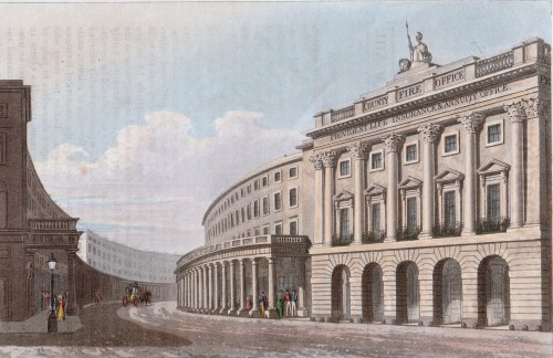
Mr Whittock recommended taking lodgings around Charing Cross, so the visitors would begin by walking around the southern edge of the Trafalgar Square building site and then down Pall Mall, passing through Waterloo Place, the southern end of Regent Street and continuing westwards.

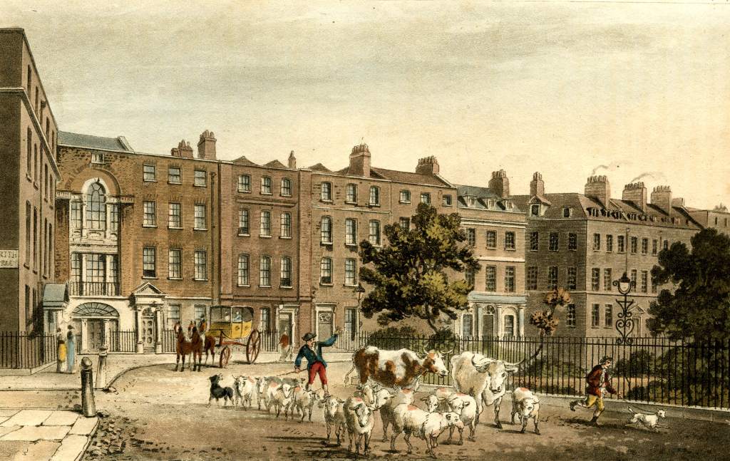
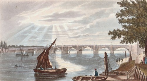
The print, from Ackermann’s Repository, shows the view looking back the way they had come. We are facing down the Strand with Northumberland House (demolished 1874) on the right. The site of Trafalgar Square is over our left shoulder and Whitehall runs off to the right. The statue is the only landmark we would recognise today – King Charles I looking down towards his place of execution. I blogged about it more extensively here.

see the Palace,

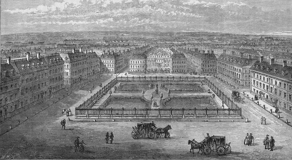
St James’s Palace, at the foot of St James’s Street, was not open to the public, but the Tudor red brick exterior with its guards was as interesting a sight then as it is, almost unchanged, now. It was no longer the residence of the monarch – that had moved to what is now Buckingham Palace – but it remained the main location for Drawing Rooms, the reception of Ambassadors and all the formal business of royalty. You can read more about it in two parts,  here and here.
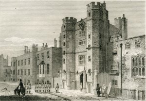
The Palace in 1809

Club-houses,

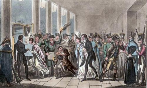
The visitors would have already passed the Athenaeum in Waterloo Place, but a stroll up and down St James’s Street would allow them to see (from the outside only, of course!) Boodles (a favourite of country squires), White’s (the oldest and smartest), Crockford’s (famous for its gambling) and Brooks’s, one of Byron’s clubs, (seen in the print, 1808 – the room looks just the same today with the same tables)

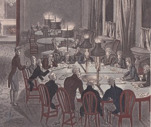
In one corner of the Great Subscription Room a tense game is underway with a large pot of winnings in the centre

and British Gallery, if open;

That would involve walking back along Pall Mall a little to number 52, the home of the British Institution.  Otherwise known as Pall Mall Picture Galleries or the British Gallery, it was founded in 1805 and was considered elitist and conservative by many artists. It was disbanded in 1867. The print from Ackermann’s Repository (1805) shows artists copying the works on display. Interestingly, four of the seven artists are women.

walk through the Park,

This was Green Park and the visitor could access it by walking past the front of St James’s Palace.

see the New Palace, and York House;

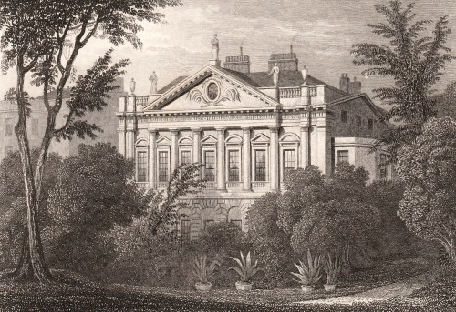
They would see the imposing façade of York House, now renamed Lancaster House, on their left just before they entered the Park. (The modern visitor has to take a rather more circuitous route). The house is now managed by the Foreign and Commonwealth Office and is let out for filming, London Fashion Week, conferences and so on. It was commissioned in 1825 for ‘the grand old Duke of York’ – Prince Frederick, Duke of York and Albany – of the nursery rhyme. The website gives more of its history and some pictures of the lavish interior.

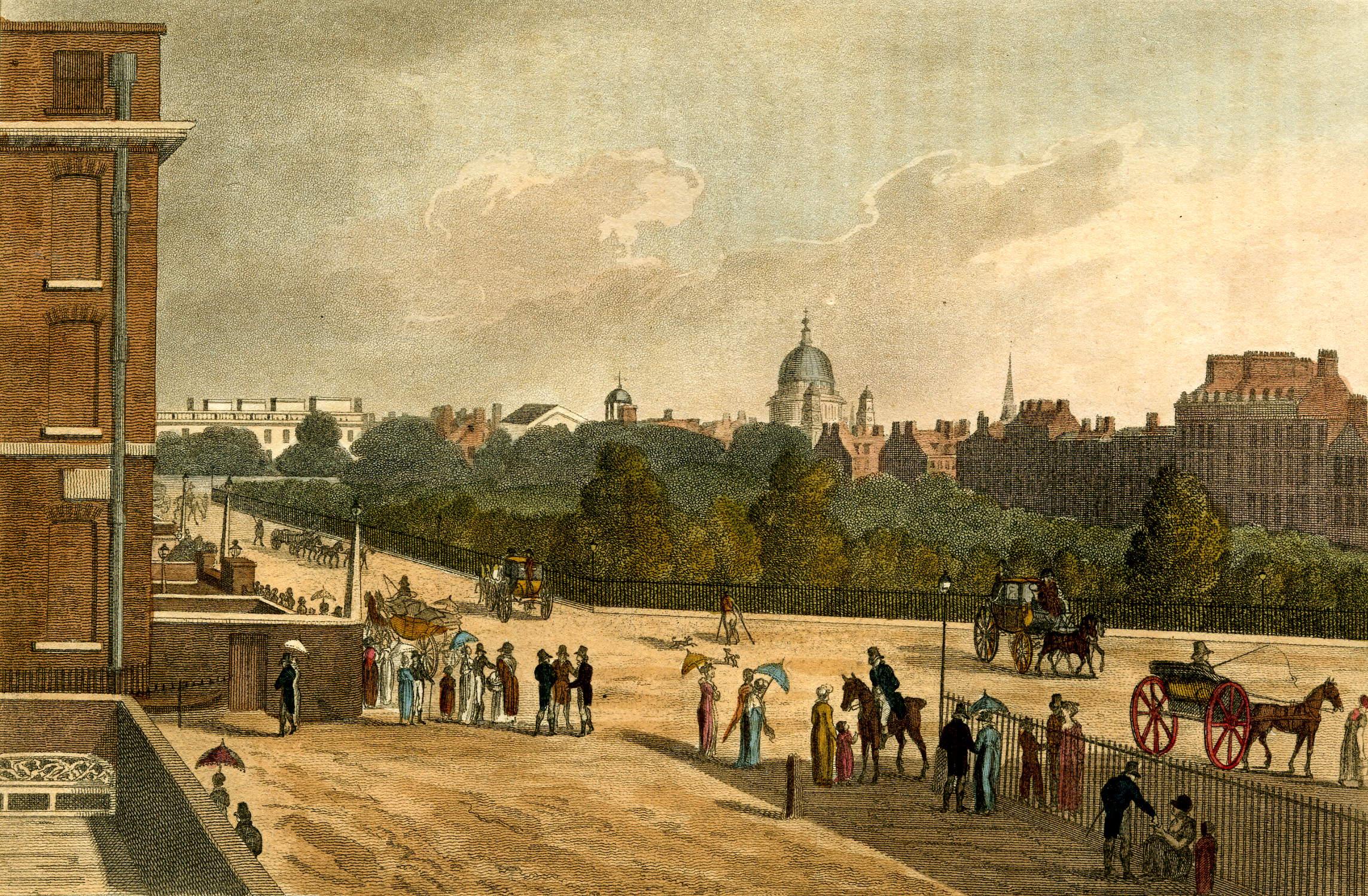
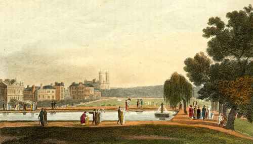
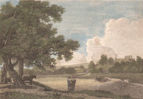
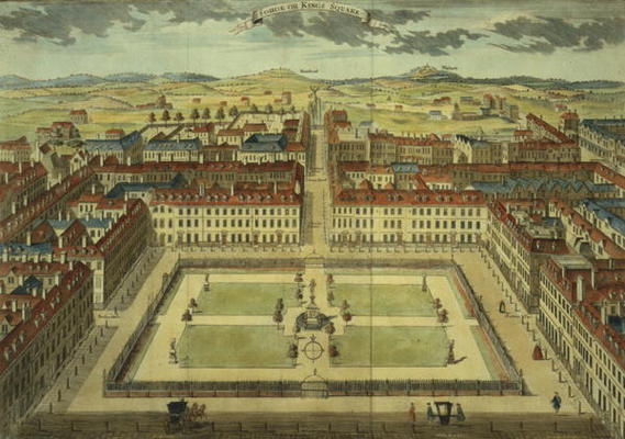
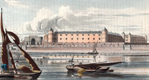
This is the view across Green Park, captioned “The Queen’s Palace from the Green Park.” It was printed in The Beauties of England and Wales published c. 1815. You can see the chimneys of the Palace on the right and some of Green Park’s famous dairy cows.

The New Palace is Buckingham Palace and would not have been open to the public. It was built as Buckingham House 1702-5 by the Duke of Buckingham and his wife, an illegitimate daughter of the deposed James II. The Buckinghams created the most opulent private house in London, apparently as a snub to the ‘usurping’ Hanoverians in their ramshackle Tudor palace across the park. George II bought it in 1762 for his wife and it became known as The Queen’s House, then, after her death, as The King’s House. His son, George IV, decided that his own palace at Carlton House was no longer adequate when he came to the throne and put in train elaborate and vastly expensive plans to enlarge and remodel the house in its stead. The final bill was £700,000, despite the Duke of Wellington, when Prime Minister in 1828, declaring, ‘If you expect me to put my hand to any additional expense, I’ll be damned if I will.’

It wasn’t finished when George IV died and his brother and successor, William IV never lived there. It was inherited by Queen Victoria in 1837 in a dreadful state – the drainage was abysmal, the windows would not open, the bells did not function…  Work continued throughout the 19th century with the final major change being the Portland stone façade on the east front in 1913.

 walk through the Green Park to Hyde Park;

This path would have been along the line of the present Constitution Road with the high walls of the Palace gardens on the left. The area in the angle formed by the junction of Piccadilly and the Palace wall was known as Constitution Hill, although there is no record of where it got that name.

see the Triumphal Arch,

This is the Wellington Arch designed by Decimus Burton. It was originally part of a scheme for improving the approach to Buckingham Palace but, just as the basic work was completed in 1828, funding cuts as a result of the vast Palace overspend left it without any of the intended decoration. In the 1830s committees were overseeing the erection of monuments to the two great military heroes, Nelson and Wellington. Nelson’s Column was achieved with little controversy but in 1838 an ill-judged decision was made to place a vast statue of the Duke on top of the arch. It was erected in 1846 to general mockery and disapproval for its disproportionate size, but the Duke threatened to resign all his posts if it was removed, seeing that as a personal slight. Eventually in 1883, when the arch itself was moved slightly to its present position in the centre of Hyde Park Corner, it was sent to Aldershot. The interior of the arch can be visited and you can see images of the original design and the arch with the statue in place on the English Heritage website.

and Statue of Achilles.

Mr Herriot’s tourists would have seen only the unadorned arch, but they would have been able to view the colossal statue of Achilles just inside the park gates behind Apsley House in all its glory. It was cast from captured French guns in 1822 to be given ‘by the women of England to Arthur Duke of Wellington and his brave companions in arms.’ Not only was it six metres high but it was completely nude – with everything in proportion. The outcry was such that a small fig leaf was added, causing further complaints that it was not large enough!

The Cruikshank print is entitled Monstrosities of London (1822) and it is the dandies and the ladies in their highly fashionable outfits that are being caricatured. The statue already has its fig leaf!

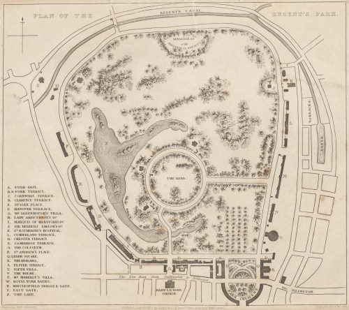
At Oxford Street Gate, ride to the Zoological Gardens, spend two hours,

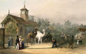
The Zoological Society of London was founded in 1826 and its collection of animals was opened in 1828 on the site at the north of Regent’s Park. There were 30,000 visitors in the first seven months. The contents of the Rooyal Menagerie from Windsor were added in 1830 and the animals from the Tower of London were moved there in 1832-4. Mr Herriott’s visitors would have been able to view monkeys, bears, llamas, zebras, kangaroos, emus, turtles, an Indian elephant, an alligator, huge snakes, Tommy the chimpanzee, four giraffes and visit the camel house (shown in the print of 1835).

 return by Portland Place to Oxford Street; visit the Bazaars,

There were shops in Oxford Street, but it was not until later in the century that the great department stores we associate it with now were developed. It would have had many smaller shops and bazaars which would have been cheaper than the establishments in, for example, Bond Street.

return home, dine, and in the evening, visit Braham’s New Theatre, recently erected in King Street, St. James Square.

The theatre, better known as the St James’s Theatre, was situated immediately opposite the junction with Bury Street. It was demolished in 1957 and replaced by a bland office block.

This theatre is the last erected, and is certainly the most beautiful minor theatre in the metropolis; it is opened under a licence from the lord chamberlain, granted to this favoured votary of Apollo, who has been the leading singer, not only of England, but of Europe, upwards of thirty years. The exterior is plain, but the interior is superb. The boxes are supported by cariatydes [sic], and the ornaments are of the most gorgeous description, in the style used in France during the reign of Louis XIV. The performances are operas, and farces; Braham frequently appears in both, and being seconded by an excellent company, it would be a matter of surprise if the theatre was not fashionably and numerously attended. The prices of admission are, to the boxes, five shillings; pit, three shillings; gallery, one shilling and sixpence: the half-price commences at nine o’clock.

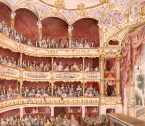
One has to wonder whether Mr Whittock was getting paid for this detailed endorsement. The theatre was a vanity project of opera star John Braham which cost him £28,000 to build. The programme was, apparently, considered unexciting and the location too far west and it consistently lost money – even ‘going dark’ in 1841. It struggled on into the 20th century under numerous managements, maintaining a reputation as an unlucky theatre. The print is by Crace, 1835, and supports Mr Whittock’s enthusiasm about the interior.

If you would like to try more detailed perambulations yourself you will find Hyde Park Corner in Walk 1 and St James’s and Pall Mall in Walk 4 of Walking Jane Austen’s London and Walks 1 & 2 of Walks Through Regency London.

1 Comment

Filed under Animals, Architecture, Art, Buildings, Entertainment, Fashions, London Parks, Monuments, Regency caricatures, Shopping, Walks, Wellington

Perambulations Through Late Georgian London or, All the Best Sights in One Week. Day Three

After  exhaustive (and exhausting) sightseeing on Monday and Tuesday, described in my previous two posts, Mr Whittock (The Modern Picture of London, 1836) has a far shorter list of places to visit for Wednesday. I suspect it would not be much less demanding.

He begins by instructing the tourist to Visit the Adelaide Gallery in Adelaide Street. This was a new street at the time Mr Whittock was writing and was part of the redevelopment of the area that is now Trafalgar Square and the National Gallery and which was the King’s and Queen’s Mews and the St Martin’s Workhouse, the Golden Cross Inn, the Phoenix Insurance company’s fire station and assorted small dwellings and workshops.

The site was cleared in 1830 but work on the hard landscaping of the Square did not begin until 1840. Those visitors guided by Mr Whittock would have seen a vast building site.

Adelaide Street runs from the Strand northwards behind St Martin in the Fields church (seen in the image of 1815). The Adelaide Gallery of Science and Art was one of the most interesting and rational exhibitions in London… and contains models of the most curious discoveries in mechanics, engineering etc. Perkin’s celebrated steam gun, the modern diving bell, the model of the process of distillation from bread and hundreds of other curiosities are exhibited here. The rooms are open daily, the admission is one shilling, and it is impossible to spend a shilling at any other exhibition in London where so much amusement and information may be gained.

Jacob Perkins, an American, patented his steam gun in 1824 and tests showed that it could fire projectiles at great pressure and could even work as a machine gun. The Duke of Wellington became interested, so did the French, the Russians and the Turks. It all came to nothing in the end in a quagmire of government indecision about spending, prejudice against ‘colonials’ and the improvement of more conventional weapons.

The London Mechanics’ Register in November 1824 wrote, If Mr. Perkins’s steam guns were introduced into general use, there would be but very short wars; since no fecundity could provide population for its attacks…What plague, what pestilence would exceed, in its effects, those of the steam gun? – 500 balls fired every minute…one out of 20 to reach its mark – why, 10 such guns would destroy 150,000 daily. If we did not feel that this mode of warfare would end in producing peace, we should be far from recommending it…We have heard, but we do not vouch for the fact, that the Emperor of Russia, who has more knowledge of the importance of steam than some of us Englishmen, has sent an agent to procure a supply of Perkins’s steam guns, which that gentleman’s patriotism will not allow him to offer…

As for distillation from bread – Googling the term produces some interesting results, including vodka from stale bread crusts!

From there we proceed to the British Museum

This was the beginning of the building we see today, although work had only begun in 1823 on a replacement for Montague House, the building purchased on the site in 1755. Visitors had to negotiate a vast building site, but much of the original remained at the time Whittock was writing, including the entrance gates on Great Russell Street. He does not say how long to allow to see the collections – which occupy ten pages in his guidebook. To secure admission it was necessary to enter one’s name and details of one’s companions in a ledger and to leave one’s walking stick, umbrella etc at the entrance. Apparently all visitors, provided they conducted themselves ‘with propriety’, were treated as equal, from noblemen to artisans, sailors and mechanics. The print of 1810 shows a new gallery to house Classical works.

Next Ride to the Regent’s Park –

Regent’s Park was originally an area of about 500 acres of royal hunting land which had become farms. The leases on the farms came due in 1811 and a scheme was formed to create  a vast public park and terraces of superior houses to be linked by a new street to Westminster. John Nash was the architect chosen and he received the enthusiastic support of the Prince Regent despite endless opposition, quibbles and delays. In 1820 work began on the terraces and on the first of eight villas. (The one shown below in a print of 18128 belonged to Thomas Raikes, dandy and diarist.) In 1828 the Zoological Society of London’s zoo was opened on the northern edge of the park and the gardens of the Royal Botanical Society occupied the centre (until 1932). The majority of the park was open to the public by 1841. The plan above is from Metropolitan Improvements with drawings by Thomas Shepherd (1827)

see the Diorama –

The Regent’s Park diorama was run by Jaques Daguerre, photographic pioneer, and was opened in 1823. The entrance was in the facade of 9-10, Park Square East and the interior was a  circular auditorium seating two hundred which could be moved through 73 degrees by a boy operating a ram engine so that two stages could be used and the scenes changed to reveal different tableaux. The main images were painted on vast rollers – 22 metres long by 12 metres high – and various props, shutters, light and sound effects added. One of the most popular was A Midnight Mass of St Etienne-du-Mont. The scene changed from daylight to candlelight, the congregation gradually appeared, midnight mass began and the organ was played. Then, gradually the congregation leaves and daylight returns.

the Coliseum –

This was at the Cambridge Gate of the park, and was designed by Decimus Burton. Despite its name it looked more looked like the Pantheon in Rome. At first the views of London which had been sketched by Mr Horner from the very top of St Paul’s Cathedral and turned into a large panorama, seventy feet tall, were very popular, but interest flagged and it was demolished in 1875. Visitors climbed staircases inside to reach the apparent height of the external gallery around the top of the dome of St Paul’s. Admission was one shilling and, for an extra six pence one could ascend by means of a moving compartment, which is a small circular room, in which six or eight persons are comfortably seated, and raised by machinery. The first elevator?

Swiss Cottage, &c. –

I have not been able to find information about the Swiss Cottage in the Park which appears to have no connection to the modern Swiss Cottage pub and area. There was a fad for ornamental buildings in this style and perhaps this was a refreshment place.

Return home down Regent Street

It was key for the success of the Regent’s Park development that it could be easily connected to what was fashionable central London at the time and the route chosen had the advantage of improving the rather squalid areas around Haymarket and Pall Mall while sorting out traffic congestion around the Strand and Charing Cross. In his words Nash’s proposal for the route will be a boundary and complete separation between the Streets and Squares occupied by the Nobility and Gentry, and the narrower Streets and meaner houses occupied by mechanics and the trading part of the community.

The section between Piccadilly and Oxford Street was devoted to shopping and was known as the Quadrant (shown above in 1822 and rebuilt in the 1920s). Lower Regent Street, between Piccadilly and St James’s Park was to be semi-residential with clubs such as the Atheneum and the section north of Oxford Street was mainly residential.

dine, and in the evening visit Astley’s Amphitheatre.

Astley’s Amphitheatre was in Westminster Bridge Road. Originally a canvas structure built by Philip Astley in 1768 it was rebuilt twice by the time Mr Whittock’s tourists visited, it would burn down again and be rebuilt in 1841 and 1862. It was finally demolished in 1893.

Astley’s was a very popular, low-brow form of entertainment with strong elements of the circus. Equestrian performers were a very important part of the shows but clowns (including Grimaldi), acrobats and tightrope acts performed and shows included melodramas, tableaus and dramatic sword fights.  You can read more about it in this post. Jane Austen visited and enjoyed it and sent Harriet Smith and Robert Martin to visit in Emma.

The weary tourist can now stagger back to his lodgings and prepare for the next day when a variety of transport awaits him – omnibus, ferry, railroad (!) and hackney carriage.


2 Comments

Filed under Architecture, Buildings, Entertainment, London Parks, Prince Regent, Walks

Perambulations Through Late Georgian London or, All the Best Sights in One Week. Day Two

Despite a packed day of sightseeing on Monday, as reported in my last post,  Mr Whittock, author of The Modern Picture of London  still expected his readers to be on parade bright and early the next day.

Starting at half-past nine, proceed eastward, enter Somerset House –

For centuries the site of a royal palace, the Somerset House we see today was built from 1775 onward with the east and west wings completed in 1835. It was used by government departments  including the Tax Office, and the Navy Office and by institutions such as The Royal Academy (until 1836), the Royal Society, and the Society of Antiquaries. The 1809 view below of Somerset House and the New Church, Strand taken from the Morning Post Office shows St Mary le Strand. The church was built in 1714-17 on the little green that used to be the site of the Strand maypole.

– see King’s College;

King’s College was founded in 1828 with the support of the Duke of Wellington, the Archbishops and thirty bishops of the Church of England to counter the foundation in 1826 of University College – ‘the godless institution’. University College was intended to educate those not of the Church of England who had previously been excluded from a university education by the regulations at Oxford and Cambridge against Roman Catholics, Jews and Dissenters.

– turn down Arundel Street, to the Temple; see the Fountain, Ancient Hall, and the church of the Inner Temple, which is frequently open in the morning.

For the modern explorer it is simplest to walk along the Strand, passing the Griffon in the middle of the road (marking the transition into Fleet Street and the City of London) and turn right under the arch of Prince Henry’s Rooms (number 17) down into the Inner Temple, one of the Inns of Court, still bustling with legal business. The Temple Church with its circular nave and Templar tombs is well worth visiting. The print  shows it in 1808 with visitors viewing the Templar graves and the photograph shows it today from a position to the left of the print.


On leaving the Temple, enter Fleet Street, onwards to Ludgate Hill, to the north entrance of St. Paul’s.

There is morning service at St. Paul’s, which occupies about three-quarters of an hour, during which time the cathedral cannot be shown; the party, in this case, if they do not wish to hear the service sung, may proceed to the Post Office, and Goldsmiths’ Hall, then return to St. Paul’s, which it is always best to view in the morning: St. Paul’s may be seen in an hour.

As he did with Westminster Abbey, Mr Whittock appears to expect his tourists to proceed briskly around major monuments.

Next visit the Bank; observe the Pay Office, the Rotunda, and some of the offices, you need not go through them all, as they are nearly alike.

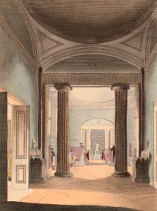
This 1811 image is of the interior courts of the Bank, designed by Sir John Soane. Now only his massive exterior wall remains and the interior has been completely rebuilt.

See the Auction Mart –

The Auction Mart, situated in Bartholomew Lane, right next to the Bank, was completed in 1810. According to an article in Ackermann’s Repository of 1811, from which these two images come, ‘Its object is to facilitate the sale by auction of every species of property, and to promote the circulation of intelligence relative to that subject.’ It contained auction rooms and also suites of offices for brokers and merchants, and a coffee room. I have included images of both the coffee room  and the hall because this is a place one rarely sees illustrated – and for the contrast between the studious young gentlemen in the coffee room and the jovial and portly gents in the hall.

– and Royal Exchange.

The Royal Exchange is between Cornhill and Threadneedle Street, opposite the Bank, and today is merely a shopping centre. The first Exchange was built by Sir Thomas Gresham in 1557 to provide a place for merchants to meet and transact business and was the origin of the Stock Exchange. The original building was destroyed in the Great Fire of 1660 and rebuilt in architecture that The Picture of London for 1807 describes as ‘of a mixed kind, in a bad taste…’ Each of the two fronts ‘has a piazza, which gives a stately air to the building.’ The upper floor was occupied ‘by Lloyd’s celebrated subscription coffee-house for the use of the underwriters and merchants’ – the origins of Lloyd’s of London, the insurers. This building burned down in 1838 and the one you see now was opened in 1844. Although it is now a shopping and eating venue its steps are still one of the places where a new sovereign is proclaimed.

By way of rest and refreshment, take a basin of soup at Birch’s, or any of the coffee-houses about the Exchange.

Ralph Rylance in his The Epicure’s Almanac (1815) says, ‘Let us not pass Alderman Birch’s unique refectory in Cornhill, opposite the Bank of England, without a tribute to the talents, literary as well as culinary, of the worthy alderman, who having written and published on the theory of National Defence, has here illustrated his system practically, by providing a variety of superior soups and pastry wherewithal to fortify the stomachs, and stimulate the courage of all his Majesty’s liege subjects. These aliments are served up in a  superior style. On the tables are placed lemons, cayenne, and other condiments, with toasted French bread for the free use of the visitants. Throughout all the turtle season, is served up in positive perfection that maximum of high diet, real turtle soup. Here is also fine genuine forest venison exposed for sale.’ Alderman Birch was Lord Mayor in 1814 and the shop provided the turtle soup for the Lord Mayor’s Banquet. The premises on Cornhill remained until 1926.

Proceed down King William Street –

In 1829-35 King William Street was driven across a tangle of minor streets to run from the junction of Cornhill, Lombard Street and Cheapside to meet Cannon Street and then turn down to the new London Bridge – this was a very new route that the visitor was being directed along.

to London Bridge

This was the new bridge built 1823-31 by Sir John Rennie, slightly upstream of the famous Old London Bridge. (Rennie’s bridge is the one now re-erected in Arizona and the present bridge was built 1971/2)

and thence to the Tower

The Tower of London had, by the time Mr Whittock was writing, lost its menagerie to the Zoological Society of London, but the visitor could still be conducted around ‘to any part they may wish to see’ by the Yeoman Warders.  Once again, Mr Whittock evidently expects the tourist to proceed at a fast pace because, having ‘done’ the Tower they still have a lot to do.

– and the Mint (‘the workshops are inaccessible to strangers’) ; survey St. Katherine’s Dock. Then take a boat from the Tower, and you will see the Custom House, London, Southwark, and Waterloo Bridges, with the buildings on either side of the river.

Optimistically, our guide informs us that we should Return to dine in your own apartments at five o’clock; when, by seven o’clock, the party will be sufficiently rested to enjoy the play at Covent Garden Theatre.

If you would like to try this route you can cover the majority of it by combining Walks 7 and 8 in my Walking Jane Austen’s London and Walk 9 in Walks Through Regency London


2 Comments

Filed under Architecture, Buildings, Entertainment, Monuments, Walks

Just A Dip in the Street? One of London’s Lost Rivers

Last week, on a visit to London, I got off a bus on Ludgate Hill, walked down to Ludgate Circus and turned left down New Bridge Street towards the Thames, ignoring Fleet Street rising up straight ahead. It is something that workers and tourists do in their thousands every day of the week, but I wonder how many of us think about why there is such a steep hill and dip in the street just there. The clue is in Fleet Street and the valley was, of course, caused by the River Fleet, now flowing under New Bridge Street in the guise of a sewer to its virtually invisible outfall in the Thames.

The map below is a section of Cary’s New Plan of London (1784)

Blackfriars

Travelling about London one tends not to notice its dips and hills. I have posted in the past about taking the 23 bus and experiencing the dip not only of the Fleet but also the Tyburn Brook in Oxford Street. On the map above the streets with ‘hill’ names help us map the course of the Fleet. At the top of Fleet Market, formed when the river was covered over in 1733, Holborn Hill and Snow Hill dip down from west and east and the course of the river continues northwards under Saffron Hill.

New Bridge Streetfull size

The image above is from Ackermann’s Repository May 1812, “from a drawing by that eminent artist in water-colour painting, Mr Frederick Nash.” The artist shows the scene as though he is standing in the middle of Ludgate Circus (although the maps of the time do not give the junction a specific name). The bump of Blackfriars Bridge is just visible in the far distance, Fleet Street is to the right and Ludgate Hill to the left.

“The obelisk at the north end of this street, as shewn in the view, was erected to give safety to the public crossing, in the year 1775, during the mayoralty of the celebrated John Wilkes.” (Wilkes (1725 – 1797) was a  radical, journalist, libertine and Member of Parliament. He was also an enthusiastic supporter of American independence although he grew increasingly conservative with age.) The obelisk has long gone, unfortunately.

The Fleet rises on Hampstead Heath, as does the Tyburn, but there is no trace these days other than the three swimming ponds on the Heath. In the Middle Ages it was still navigable by barges as far as Holborn Bridge, to the north of the section in this map of 1563. Fleet Bridge is named and below it was the Bridewell Bridge , “said to resemble to Rialto at Venice” according to Ackermann’s – it  certainly seems to be covered. Before the Great Fire it was made of wood, but was replaced in stone with two arches.

Blackfriars 1563

Bridewell, which has now vanished, began as a palace and rapidly deteriorated into a prison. I traced its history here.

In 1733 the length between the Holborn and Ludgate bridges was covered and became Fleet Market – the double row of stalls can be seen in Roque’s map of 1738/47 (below). The Fleet Prison shows clearly, middle top, – the curve of the wall is still reflected in the building line today.

Below Fleet Bridge the  Bridewell Bridge has disappeared and the Fleet itself is labelled ‘Fleet Ditch’, an apt name by then – it was a stinking mass of refuse. Pope in his Dunciad writes of it:

Fleet Ditch, with disemboguing streams,

Rolls the large tribute of dead dogs to Thames;

The King of Dykes! than whom no sluice of mud,

With deeper sable blots the silver flow.

Or, to quote Ackermann’s rather more prosaic description, “…in the state of a muddy and loathsome ditch, until the building of Blackfriars-Bridge in the year 1768. In the place of this ditch, which had become a serious public nuisance, has sprung up the noble street, exhibited in this view [ie the print above], called New Bridge-street.”

Blackfriars Roque

The original Blackfriars Bridge was begun in 1760 and was finally completed in 1769, although it was open to pedestrians in 1766 and to riders in 1768. It was intended to name it for the Prime Minister, William Pitt, as the remaining inscription still confusingly explains, but popular usage soon had it named for the area, the site of the old Black Friars’ monastery. Repairs took place in 1832, but the bridge deteriorated to such an extent that a new one was proposed. It took years, the building of the Thames Embankment and the demands of the railways, but in 1869 and new bridge was opened. (The parallel railway bridge, just downstream, opened in 1864).

After exploring the area, the marvellous Art Nouveau Blackfriar pub just before the bridge is an excellent place to have lunch and to admire the depiction of the monks who once inhabited the area. (Get there early – it is very popular!)


Leave a comment

Filed under Architecture, Buildings, Maps, Rivers, Transport and travel, Walks

Story of a Square 4: Leicester Square – From Common Land to Fashionable Residence to Popular Entertainment Centre

For Jane Austen the Leicester Square area was the location of some of her favourite shops. Until 1630 it was Leicester Fields, common land available for parishioners of any class to dry clothes and to pasture their livestock after Lammas Day (12th August). But London was moving out from its old centres and the Earl of Leicester acquired the area in 1630 in order to build Leicester House. That occupied, more or less, the area between today’s Lisle Street and the Northern edge of the Square. To the East it finished more or less where Leicester Place is and to the West on a line where the edge of the Empire cinema stands. Lisle Street ended at the Western edge of its gardens.

The parishioners were, naturally, unhappy about this incursion on their land and rights and Charles I had to appoint a Privy Council committee to arbitrate. His lordship was ordered to make compensation and he had a high brick wall built along the Southern boundary (the current pavement line, more or less) and, in accordance with the committee’s instructions, had the rest of the land – the present Square – turned ‘into Walkes and planted with trees along the walkes and fitt spaces left for the Inhabitantes to drye their clothes there as they were wont, and to have free use of this place.’ As the other sides of the open area were built on the contractors railed off the centre and planted elms. The map at the top is a detail from Roque’s map of 1740.

In 1670 Leicester Square was laid out for ‘the benefit of the family, the advancement of their revenue, and the decency of the place before Leicester House.’ This was an indication that fine houses were being built around the Square. By the early 18th century there was a brick wall with iron railing and in 1784 a statue of George I in armour and on horseback was moved from the garden of the Duke of Chandos’s house to the centre. The gardens gradually deteriorated and so did the statue which lost a leg. It was finally sold for scrap for £16 in 1872.

Part of the Leicester estate, including the Fields and surroundings was acquired by the Tulk family in 1808. By this time all four sides of the Square were built up with fine houses and no commercial development had been permitted although by 1782 there was a linen draper by the name of Gedge operating at the corner with Cranbourn Street (running from the top Eastern corner of the Square). Six earls had residences in the Square and several artists, writers and men of business lived there. Hogarth created Marriage à la Mode, Rake’s Progress, Industry and Idleness and Gin Lane at no.30 and Joshua Reynolds lived at no.47 from 1760 to 1792. All the fine 17th and 18th century houses have gone now, replaced by buildings of the late 19th century onwards.

By the end of the 18th century the area had become rather less select and had taken on the form shown in the second map above. The Earl of Rockingham had lived at no.27 until his death. It became a bagnio – technically these were bathhouses, but more usually were brothels. This was the location for the great hoax of 1726, the place where anatomist Nathaniel St Andre brought Mary Tofts, a poor women from Surrey whom, he claimed, had given birth to a litter of 15 rabbits after being frightened by one when walking through a field. The story attracted George I’s surgeon who was taken in and claimed to have delivered her of part of another rabbit. Sir Hans Sloane, President of the Royal Society arrived to view the birth of yet more rabbits. Eventually she was caught buying rabbits and the scam was exposed.  The bagnio and the sensational hoax perhaps mark the beginning of Leicester Square as a centre for popular entertainment, although as this print of 1812 (from Ackermann’s Repository) shows, it was still a very smart area.

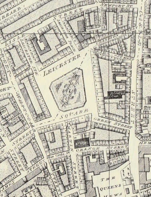
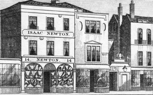
The view is from Leicester Place down to the North-East corner of the Square. If you stand there today you can still see the indentation in the street on the right hand side – I love how landholdings like this are reflected years later in the modern building line.

Jane Austen came to the area to shop, especially when she was staying with her brother Henry in Covent Garden. Prices were slightly lower than those in the Mayfair area and she patronised Isaac Newton the linen draper in Leicester Place whose unimaginative approach to window dressing can be seen in this print. Next door is a doorway with a sign over it “Rome Malta” which was the entrance into Barker’s Panorama, opened in 1793. It was a rotunda of 27 metres in diameter. It’s two rooms, one above the other, displayed perspective views of famous scenes and locations which could be viewed ‘in the round’ from the centre

of each room. Jane Austen also shopped for bonnets and caps in Cranbourn Alley.  On a snowy day in March 1814 she wrote to her sister Cassandra,

‘Here’s a day! The Ground covered with snow! What is to become of us? We were to have walked out early to near Shops, & had the Carriage for the more distant… Well, we have been out, as far as Coventry St; Edwd escorted us there & back to Newtons, where he left us, & I brought Fanny safely home.’ On that snowy shopping trip she saw, ‘A great many pretty Caps in the Windows of Cranbourn Alley! I hope when you come, we shall both be tempted.’ Intrigued, I set out to find Cranbourn Alley which runs between Cranbourn Street and Bear Street. It is still there – and a horrible little passageway it is now. I wouldn’t want to walk down it in daylight, let alone at night!

By the mid 19th century the ‘garden’ in the centre of the Square was so derelict that it had the Great Globe, a vast ball-shaped panorama built on it in 1851. Later it became a wasteland with occasional circuses, poor quality stalls and was used as a waste tip. It was surrounded by high wooden hoardings covered in advertisements  until in 1873 the Master of the Rolls had them removed and ordered that the area be returned to use as a garden. It was rescued in 1874 when it was bought by the flamboyant, and very rich, MP for Kidderminster, Albert Grant, who was created a baron by the King of Italy. He had the garden laid out much as it is today with a fountain and bust of Shakespeare in the centre. It was refurbished in 1992.

It seems difficult to see anything of the Georgian and Regency periods in Leicester Square today with its vast crowds of tourists queuing for theatre and cinema tickets, its souvenir shops and its endless food outlets. However, when I researched the area for Walking Jane Austen’s London and Walks Through Regency London I found plenty of fascinating reminders within a short distance. There’s Freibourg & Treyer’s shop, the oldest surviving in London,  in Haymarket. In Gerrard Street you can climb the stairs that Doctor Johnson and Joshua Reynolds would have used in the days when no.9, now a Chinese supermarket, was the famous Turk’s Head coffee house. The area has numerous Regency-era shopfronts too, especially in Lisle Street. Then you can have a drink and sandwich in Tom Cribb’s pub on Panton Street and escape the crush around the Square!


Save

Save

Save

Save

Save

Save

Save

Save

Save

Save

Leave a comment

Filed under Architecture, Buildings, Entertainment, Shopping, Walks

The Story of a Square 3: Lincoln’s Inn Fields

lincolns-inn0001

Lincoln’s Inn Fields is the largest square in London and records exist concerning it from the 14th century when it really was a field – or rather, two – Purse Field and Cup Field. They adjoined the west wall of the grounds of Lincoln’s Inn, one of the four Inns of Court, and were the natural playground for the legal students’ ball games. The survival of this vast open space in the middle of the city, surviving Stuart property developers and massive Victorian road improvements and slum clearance, is due to an early example of NIMBYism.

In the Middle Ages, and well into the 17th century, there was nothing resembling a civilized park – the fields were leased out as pasture and, occasionally, used as places of execution. In 1586 the Babington Plot conspirators were hanged, drawn and quartered there, Catholic martyrs were burned in the 1580s and Lord Russell was beheaded in about the centre in 1683 for his involvement in the Rye House Plot.

As London expanded outwards developers began to cast an eye over such a tempting expanse of open ground and the first attempt to build a house there was in 1613. This was successfully resisted by the Society of Lincoln’s Inn – lawyers powerful enough to influence the government on the subject. It was clear that improving the open space would assist in preserving this asset, so the Society and the neighboring parishes petitioned Charles I in 1617 that “for their general Commoditie and health [the fields should be] converted into walks after the manner of Morefeildes.” The proposal appealed to the King and the Privy Council supported the scheme “as a means to frustrate the covetous and greedy endeavors of such persons as dailye seeke to fill up that small remainder of Ayre in these parts with unnecessary and unprofitable Buildings.” Resistance to developers seems to be as strong then as it it now.

Neither development nor improvement as an ordered public space happened immediately, but in the 1630s the leaseholder of the fields petitioned the King to allow the building of 32 houses. After some wrangling the permission was granted but the developer agreed that the centre of the area was  “for ever and hereafter to be open and unbuilt.” The houses were built by 1641 and the area became a fashionable place to live despite the Fields themselves being a dangerous place with fights and robberies (and the odd execution) commonplace.

In 1716 John Gay wrote  in Trivia that, despite the square being railed, it was unwise to venture in at night. The beggar that the benevolent pedestrian had given coins to during the day would turn his crutch into a weapon at night “and fell thee to the ground” and the linkboy offering to guide him through the area will lead him into the clutches of robbers and “quench the flaming brand and share the booty with the pilfering band.”

Nell Gwynne had lodgings here, and another of Charles II’s mistresses, the Duchess of Portland, had a house. Numerous aristocrats, politicians and high-ranking lawyers lived around the Fields in the 17th, 18th and 19th centuries but the person whose name is nowadays most closely associated with the square is the architect Sir John Soane. His house is now one of the most atmospheric and eccentric museums in London and is located in the middle of the north side. The print at the top of this post, from Ackermann’s Repository, shows the view from the north-west corner in 1810 and you can get more or less the same view today by standing at the point where Gate Street and Remnant Street enter the Fields. (The Remnant name reflects the fact that this was once the end of Great Queen Street before the Victorians drove Kingsway through the tangle of medieval streets to the west of the Fields.)

The tall buildings to the right of the print occupy the site of what is now the Royal College of Surgeons which contains the extraordinary Hunterian Museum, a fascinating, if gruesome place to visit for anyone interested in the history of surgery and anatomy.

Lincoln’s Inn Fields is included in Walk 7 of Walking Jane Austen’s London (an excellent stocking-filler for any history buff’s Christmas stocking!) As well as the two museums there are still a number of fine 18th century houses and the gardens themselves to enjoy – open to the public since 1894.


Save

Save

Save

2 Comments

Filed under Buildings, London Parks, Science & technology, Walks

The Story of a Square 2: Berkeley Square

Berkeley (or Berkley as it is often spelled on early maps) Square was built on the farmland owned by John, 1st Baron Berkeley of Stratton, a Royalist military commander in the English Civil War and close friend of James, Duke of York (later James III) who did very well for himself after the restoration of Charles II . Amongst other things he was a co-founder of the Province of New Jersey. Berkeley acquired extensive farmland to the north of the Exeter Road in London, now Piccadilly, and in 1665 he had a mansion built there. Today it would occupy the block bounded by Piccadilly, Stratton Street and Berkeley Street, with its gardens (partly designed by John Evelyn) stretching northwards. In the map below of 1682 ‘Berkley House’ can be seen just above the ‘ETC’  of The Road to Exeter Etc.’ (The area marked ‘St James Park’ is now known as Green Park.)

map-1682

Evelyn records that it cost “neare 30,000 pounds” and called it a “palace”. After Lord Berkeley’s death in 1678 his widow sold off strips at the side of the grounds to create Stratton Street and Berkeley Street, much to Evelyn’s disgust. Princess (later Queen) Anne occupied the house 1692-5 during a spat with her sister Queen Mary and in 1696 it was sold to the Duke of Devonshire and renamed Devonshire House. It was rebuilt after a fire in 1734/7 and this is the house that can been seen in Horwood’s map of 1799/1819. The reservoir in Green Park mentioned in a recent post can be seen at the bottom.

map-horwood

One of the conditions of the sale was that view over the land to the north of the gardens should be unobstructed and this is one reason why, when the area was developed, that Lansdowne House is set to one side with its gardens respecting the view from the rear of Devonshire House and there was no building along the south side of Berkeley Square.

The square was laid out in 1730 with houses on the east and west sides.The east side was the first to be built and was finished about 1738 and the west side was completed in 1745. Of these houses only the western side remains intact – the 1930s saw the replacement of the eastern side and the garden wall of Lansdowne House – and the site of Mr Gunter’s famous establishment in the south-east corner is now under a branch of Prêt. The customers still take their refreshments outside to eat under the plane trees – although rather less elegantly than Mr Gunter’s patrons would have done. It was originally the shop of Dominicus Negri, an Italian pastrycook, who set up there in 1757, trading as The Pot and Pineapple.

In the centre was  an equestrian statue of George III – a not very successful effort whose legs soon collapsed. It was replaced by the little pump house with a Chinese roof which has survived. The famous plane trees are perhaps the most striking survival of the Georgian square and were planted in 1789.

Ackermann’s Repository featured the square in September 1813 with this view which appears to be the south-west corner with the wall of Lansdowne House’s gardens in the background.

ackermann-1813

According to the text “This square is distinguished from all the others in the British metropolis by its situation on the side of a hill, which gently slopes from north to south. the houses on the north side are, upon the whole, rather mean; those which form the east and west sides, though many of them, individually, very good buildings, do not, from the want of regularity, appear altogether to such advantage as where greater attention is paid to that point, and where the site is more favourable to it… The area, which forms an oblong square, containing about three acres, is inclosed by an iron balustrade; and the inhabitants, after the example of their neighbours, have, of  late years, caused it to be planted extensively with shrubs, which have thriven very rapidly, and give a rural air to the whole.”

victorian

This late Victorian print shows the southern end of the square, looking west with the Lansdowne wall on the left.

Nowadays it needs some care to recapture the Georgian spirit of the square, but it can be done, especially when sitting in the shade of the plane trees and looking at the wonderful ironwork of the western side. But don’t expect to hear a nightingale singing in Berkeley Square – they probably flew off in the 1730s when the builders moved in!

You can visit Berkeley Square on the Mayfair walk in my Walking Jane Austen’s London.

Save

Save

Save

Save

1 Comment

Filed under Architecture, Buildings, High Society, Walks

“One of the Most Agreeable Walks in London” – a stroll through The Green Park

Green Park0001

“No inhabitant of the metropolis, and scarcely any person who has visited it, needs to be told that the spot delineated in the annexed view [above] forms one of the most agreeable walks in London.” (Ackermann’s Repository October 1810).

This shows the eastern end of The Green Park (these days ‘The’ is always dropped) from Piccadilly, looking south. It seems the artist would have been somewhere between Clarges Street and Bolton Street. Westminster Abbey can be seen in the distance and on the left are the houses looking out onto the Queen’s Walk. St James’s Palace is hidden behind them at the far end. Nowadays Green Park tube station would be just out of sight on the left with the Ritz (on the site of The White Horse Cellar) just beyond that.

“In summer the eastern end of the Green Park forms a favourite promenade for the inhabitants of the metropolis: and in fine weather, on every evening and on Sundays in particular, is always extremely crowded with genteel and well dressed company. At the north-east corner of this park there is a fine piece of water, which is supplied by the water-works of Chelsea [The reservoir was built in 1775 and filled in in 1856] and forms at once a beautiful embellishment and a useful reservoir. The guards parade every day between ten and eleven o’clock, and a full band of music renders this spectacle cheerful and attractive.” (John Wallis London: Being a Complete Guide 1810)

Green Park is a triangular space of about 53 acres. To the south Constitution Hill divides it from the gardens of Buckingham Palace and St James’s Park butts up to it in the south-east corner with the Mall. In the 17th century it was part of St James’s Park, the Tudor hunting grounds, which swept around the south and west of the palace, but by the time of Roque’s map of 1738 the tree lined avenue of the Mall leading up to Buckingham House cut it off and it is labelled The Green Park. The gardens of Buckingham House were much smaller and the park crossed Constitution Hill, occupying the area that is now the large roundabout of Hyde Park Corner. The second print is from The Beauties of England & Wales Vol. 1 (1801) and shows the view west from the southern edge of the park towards Buckingham House which, by that time, had become The Queen’s Palace or House.

Green Park Q House

Before Henry VIII seized monastic properties St James’s Palace was the site of a religious foundation and a leper hospital and the legend persisted that Green Park was so green (and without flowers) because it was the burial place for the lepers. There is no evidence for this! Charles II was responsible for the park’s lay-out and Constitution Hill is thought to be named because it was a favourite walk, or ‘constitutional’ of his. He also built a snow, or ice, house and the mound can still be seen in the park opposite 119, Piccadilly.

The park, as well as being a fashionable promenade, was also popular for duels in the 18th century. Count Alfieri fought Lord Ligonier the husband of his mistress there and famously remarked (when he returned from the fight to finish watching the play at the Haymarket Theatre with a wounded arm) “My view is that Ligonier did not kill me because he did not want to, and I did not kill him because I did not know how.” The park was also an excellent location for balloon ascents and firework displays such as the 1814 Peace celebrations.

The gravel walk on the eastern boundary of the park is known as The Queen’s Walk and was created for Caroline, the wife of George II. She had a pavilion built for breakfasts looking out on the park, but no trace of it remains. The most distinguished house overlooking the Walk is Spencer House. It can be seen in the top print, identified by the roof ornaments, and in the print below. (1831  Earl Spencer’s House). It is open to the public  on Sundays (except in August) by bookable guided tours.

spencer


Save

Save

Save

Save

2 Comments

Filed under Architecture, High Society, London Parks, Royalty, St James's Park, Walks