Category Archives: Maps

The Story of a Square 7: Finsbury Square

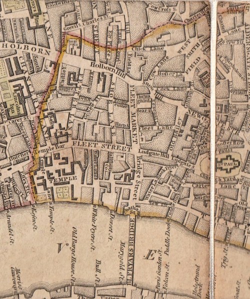
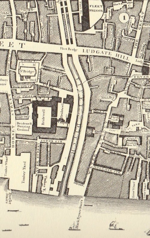
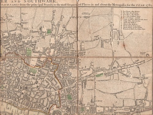
In my occasional series on the history of London Squares I am going eastwards to Finsbury Square, shown outlined in green in Horwood’s map of c1800.

Finsbury Square was built between 1777 and 1791 in an attempt, according to The London Encyclopaedia, to ‘recreate a West End atmosphere near the City’. The principal architect was Charles Dance, but others were involved, and each side of the Square was different. It was severely damaged during World War II and now none of the original buildings remain, nor the circular central garden.

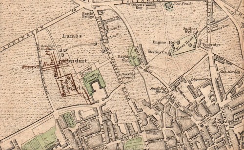
It was built on the land marked on Roque’s map (1740s) below as Upper Moor Fields.

This was originally part of a larger marshy fen or moor outside the City walls which was fully drained in 1527. It ran from immediately north of the City walls and ditch, with the Wall Brook, draining into the City ditch, on the eastern side and a causeway (now the A501, City Road) to the west. Where the causeway met London Walls was the Moor Gate, built 1414 by the Lord Mayor Falconer ‘for ease of citizens that way to pass…into the fields…for their recreation.’ The print shows it at the time of its demolition in 1762.

On the western side Cheselstrete, now Chiswell Street, came in at a right angle to an area of the Moor called Mallow Field, bounded on the east by the parish boundary between St Leonard Shoreditch (east) and St Giles Without Cripplegate (west). The eastern part of the moor in St Leonard’s parish was simply called The Moor and, by the time of Roque’s map, was built over.

To the south of the junction of the causeway with Chiswell Street was the northern boundary of the City, By the 1740s narrow Ropemaker Alley ran along that line to the west and is now Ropemaker Street.

South of the City boundary and north of the Wall was Moor Field, its distorted rectangular shape preserved in the formal landscaped area behind the Bethlem Hospital marked as Moor Fields on Roque’s map. Finsbury Circus (1815-17) occupies much of this area today.

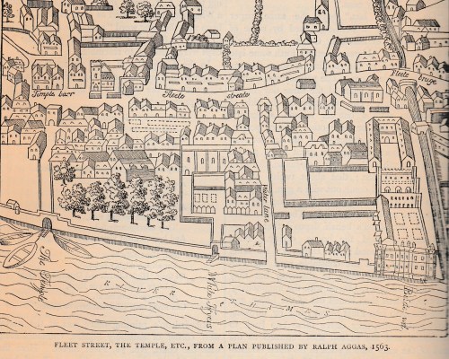
A 16th century illustrated map (below) shows these areas shortly after they were drained. Animals are pastured, archery practice is going on, laundry is laid out to dry and cloth is being stretched on tenterhooks. Finsbury Square occupies the area approximately where the horses are grazing.

By the 1740s the tenter grounds were clearly defined and laid out to the east and north of Upper and Lower Moor Fields and the adjoining Upper Moor Field to the west and, stretching up further north, was The Artillery Ground. The Honourable Artillery Company (who still provide the salutes at the Tower and on state occasions) continue to occupy the site which is now their sports field with the headquarters to the north. In 1672 Moor Gate was rebuilt and made higher so that the trained Bands (the local militia) could march through with their long pikes upright on their way to military exercises on the Moor.

In 1785, as work began on Finsbury Square, Vicenzo Lunardi, the Italian pioneer balloonist, took off from the Artillery Ground with a vast and excited crowd spilling out over the Moor all around. (He landed safely near Ware, in Hertfordshire.)

John Wallis, in his London (quoted below), incorporates  Pennant’s London Improved which mentions Moor Fields, describing the area immediately to the north of Bethlem Hospital as “The City Mall” a popular, tree-lined promenade.

The upper part which had been partly enclosed with a dwarf wall, contained waste, and was long a rendezvous for the boxers and wrestlers that composed old Vinegar’s [a bare knuckle boxer] Ring; and for mountebanks, methodist preachers, old iron stalls, etc.

Upper Moor Field might not, with its military drills, the gunfire of the Artillery Company and its use for such displays as balloon ascensions, fights and scrap iron sales,  seem to be an ideal place to erect a fashionable square. John Wallis in his London: Being a Complete Guide to the British Capital (1810) remarks:

A sudden transformation, as it were, of a marshy moor into the magnificent abodes of some of the wealthiest merchants in the metropolis, cannot be otherwise than interesting to the curious observer.

[An] improvement, truly magnificent, must certainly be admitted in the erection of Finsbury-square, and those new and elegant edifices which now cover all the northern site of ancient Moor-fields. This erection commenced about 1777. After this period the west side being erected first, the others rose with as little interruption as possible, and the whole was nearly inhabited in 1783; the rents, which then produced £4792, in 1797 encreased [sic] to £7598.

It is believed that Finsbury Square was the first public space permanently lit by gas.

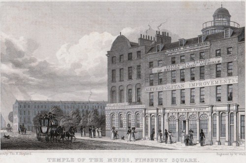
The best-known occupant of Finsbury Square is probably Lackington’s Library, known as the Temple of the Muses, in the south-east corner. This vast shop, with a frontage of over forty three metres held a stock of thousands of volumes. I have devoted a post to London libraries, including Lackingtons, and you can read more about it here.

The exterior is shown below, in a print of 1828 when it was no longer owned by James Lackington. It burned down in 1841.


5 Comments

Filed under Architecture, Books, Buildings, Maps

Just A Dip in the Street? One of London’s Lost Rivers

Last week, on a visit to London, I got off a bus on Ludgate Hill, walked down to Ludgate Circus and turned left down New Bridge Street towards the Thames, ignoring Fleet Street rising up straight ahead. It is something that workers and tourists do in their thousands every day of the week, but I wonder how many of us think about why there is such a steep hill and dip in the street just there. The clue is in Fleet Street and the valley was, of course, caused by the River Fleet, now flowing under New Bridge Street in the guise of a sewer to its virtually invisible outfall in the Thames.

The map below is a section of Cary’s New Plan of London (1784)

Blackfriars

Travelling about London one tends not to notice its dips and hills. I have posted in the past about taking the 23 bus and experiencing the dip not only of the Fleet but also the Tyburn Brook in Oxford Street. On the map above the streets with ‘hill’ names help us map the course of the Fleet. At the top of Fleet Market, formed when the river was covered over in 1733, Holborn Hill and Snow Hill dip down from west and east and the course of the river continues northwards under Saffron Hill.

New Bridge Streetfull size

The image above is from Ackermann’s Repository May 1812, “from a drawing by that eminent artist in water-colour painting, Mr Frederick Nash.” The artist shows the scene as though he is standing in the middle of Ludgate Circus (although the maps of the time do not give the junction a specific name). The bump of Blackfriars Bridge is just visible in the far distance, Fleet Street is to the right and Ludgate Hill to the left.

“The obelisk at the north end of this street, as shewn in the view, was erected to give safety to the public crossing, in the year 1775, during the mayoralty of the celebrated John Wilkes.” (Wilkes (1725 – 1797) was a  radical, journalist, libertine and Member of Parliament. He was also an enthusiastic supporter of American independence although he grew increasingly conservative with age.) The obelisk has long gone, unfortunately.

The Fleet rises on Hampstead Heath, as does the Tyburn, but there is no trace these days other than the three swimming ponds on the Heath. In the Middle Ages it was still navigable by barges as far as Holborn Bridge, to the north of the section in this map of 1563. Fleet Bridge is named and below it was the Bridewell Bridge , “said to resemble to Rialto at Venice” according to Ackermann’s – it  certainly seems to be covered. Before the Great Fire it was made of wood, but was replaced in stone with two arches.

Blackfriars 1563

Bridewell, which has now vanished, began as a palace and rapidly deteriorated into a prison. I traced its history here.

In 1733 the length between the Holborn and Ludgate bridges was covered and became Fleet Market – the double row of stalls can be seen in Roque’s map of 1738/47 (below). The Fleet Prison shows clearly, middle top, – the curve of the wall is still reflected in the building line today.

Below Fleet Bridge the  Bridewell Bridge has disappeared and the Fleet itself is labelled ‘Fleet Ditch’, an apt name by then – it was a stinking mass of refuse. Pope in his Dunciad writes of it:

Fleet Ditch, with disemboguing streams,

Rolls the large tribute of dead dogs to Thames;

The King of Dykes! than whom no sluice of mud,

With deeper sable blots the silver flow.

Or, to quote Ackermann’s rather more prosaic description, “…in the state of a muddy and loathsome ditch, until the building of Blackfriars-Bridge in the year 1768. In the place of this ditch, which had become a serious public nuisance, has sprung up the noble street, exhibited in this view [ie the print above], called New Bridge-street.”

Blackfriars Roque

The original Blackfriars Bridge was begun in 1760 and was finally completed in 1769, although it was open to pedestrians in 1766 and to riders in 1768. It was intended to name it for the Prime Minister, William Pitt, as the remaining inscription still confusingly explains, but popular usage soon had it named for the area, the site of the old Black Friars’ monastery. Repairs took place in 1832, but the bridge deteriorated to such an extent that a new one was proposed. It took years, the building of the Thames Embankment and the demands of the railways, but in 1869 and new bridge was opened. (The parallel railway bridge, just downstream, opened in 1864).

After exploring the area, the marvellous Art Nouveau Blackfriar pub just before the bridge is an excellent place to have lunch and to admire the depiction of the monks who once inhabited the area. (Get there early – it is very popular!)


Leave a comment

Filed under Architecture, Buildings, Maps, Rivers, Transport and travel, Walks

A Georgian Parlour Game

The Georgians were great believers in educational games and I own a battered and much-used copy of one of them – Wallis’s Tour Through England and Wales: A New Geographical Pastime, published in London in 1794.

The whole game measures approximately 500 x 630mm (20 x 26 inches) and is made up of 16 sections glued to a flexible backing. It folds up neatly into a slipcase approximately 175 x 140cm (7 x 4.5 inches). The slipcase has an imposing image of scrolls, flags and military drums on it, but it has had such a hard life that it is impossible to scan. There was another version of the game for Europe (on sale on the internet at over £1,000, I see) and one for the whole world. Unfortunately I doubt my battered copy of England and Wales is worth anything like that!

The same plate was also stuck onto wood and cut out so that each county formed a piece of a jigsaw – or dissected puzzle as they were known at the time. The children of George III played with these puzzles which survive at Kew Palace and can be seen here.

The instructions tell us that 2 to 6 “may amuse themselves with this agreeable pastime” for which they will need a “totum” and a pyramid (presumably some kind of marker) and four counters per player, each set in a different colour. A totum was a teetotum, a spinning top with a variable number of faces. I can recall making one as a child out of card cut as a polygon with a cocktail stuck through the centre. There are some lovely ones illustrated on this website.

Players spin the totum and the highest score starts. With their first score they place their pyramid on the corresponding town – 1, for example, would land them at Rochester. On their next turn they move on the number of towns they have scored – say 6 –  which would give them 7 and they can then move to Lewes, number 7 on the map. The winner is the first to reach London with exactly the right number. If a player exceeds the right number then he has to count backwards from London.

Each numbered town has a short description in the margins and some of these have a delay  involving missed turns. When a player lands on one of those they must deposit the stated number of counters and have to miss the next turn, or turns, until they have collected them back up again. (see 50. Worcester, in the top right hand corner of the first image). Presumably each player would be expected to read out the description of the towns they land on for the instruction of all the participants.

If you landed on 89, The Isle of Man, you would be shipwrecked and out of the game!

7 Comments

Filed under Domestic life, Education, Entertainment, Maps

Paying the Correct Fare – Hackney Carriages and Watermen

I had a wonderful auction haul of prints and maps in December – including the map that I’d gone for in the first place – Cary’s New Plan of London with the Correct List of upward of 350 Hackney & Coach Fares from the Principal Stands to the most Frequented Places in & About the Metropolis. Printed for J.Cary , Map & Printseller, No. 188, Strand.  (1784)

cover

The map measures 550×410 cm (approximately 22×16.5 inches) but has been cut into segments and mounted on a flexible backing so that it folds neatly into its handy pocket-sized slipcase, shown above (145×111 cm/5.5×4.5 inches). From the state of the cover which is intact but worn, it has been well used by its owner, possibly the J. Beauchamp who has written his name on the back of the map.

top-right

I had never seen a map with the hackney coach and watermen’s fares before, although I have guidebooks with some of the same information, so I was fascinated to read in The London Encyclopedia (2008)  “There was a certain amount of dishonesty and overcharging in both groups, so that from about 1720 makers of London maps adopted the practice of printing tables of hackney coach and watermen’s fares on the maps which they published.”

According the the Encyclopedia, hackney carriages were named from the French word hacquené (an ambling nag) and were invented by one of Raleigh’s sea captains at the end of the 16th century.

fares

The section at the bottom of the map gives fares from Charing Cross, Temple Bar, West Smithfield, Borough (ie Southwark), Oxford Street (at the Pantheon), St Paul’s Churchyard, Holborn, Hyde Park Corner, Westminster Hall, Drury Lane Theatre and Covent Garden Theatre. Here is the central portion enlarged:

fares-detail

The “Rates of Oars up and down the River for the whole Fare or Company” run along the bottom of the map and proved very difficult to scan. From London (it doesn’t say from which point) to Greenwich or Deptford it was one shilling and six pence, to Richmond, three shillings and sixpence and to Hampton Court six shillings, to take a few examples.

Mr Beauchamp appears to have found the map useful well beyond 1784 because he (or perhaps a later owner) has inked in three new developments – Brunswick Square, built 1795-1802, the Strand bridge (later known as Waterloo Bridge) of 1811 and the line of Regent Street, which must have been done post-1810, the date of John Nash’s report on the need for the new street. I wonder if this meant that the fares were unchanged or that the map was still useful as a street map.

brunswick-square

strand-bridgeregent-street

Save

Save

Save

Save

11 Comments

Filed under Architecture, Maps, Transport and travel, Travel